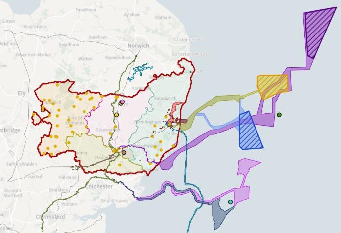
Suffolk County Council have produced a web-based public-facing interactive map to display NISPs in the county of Suffolk and neighbouring districts. Where Suffolk County Council have received written permission, the Council has published the Order Limits of each proposal. Where Suffolk County Council has been unsuccessful in obtaining written permission, point data at the centre of the NSIP has been provided. Small-scale (non-NSIP) ground-mounted solar farms are also shown as yellow dots.
Nationally Strategic Infrastructure Projects (NSIPs) throughout their lifecycle are displayed. This includes those in Pre-Application, Examination, Grant Consent. Construction and Operational.
You can access the map via this link: Suffolk CC NSIPs
The mapping tool includes several utility functions, including the ability to tap or click on each NSIP to understand its infrastructure further, and a bookmark selector which allows you to scroll through a carousel to re-focus the map on each NSIP (with a brief description).